In this guide
- 01A Label That Is True Only By Definition
- 02What "No Dams" Actually Means
- 03The River Itself
- 04Why The Shimanto's Bridges Have No Railings
- 05What Is Summer On The Shimanto River Really Like?
- 06How To Reach The Shimanto And How Long To Stay
- 07What Japan Royal Service Arranges Here
- 08Frequently Asked Questions
- 09Why Choose Japan Royal Service
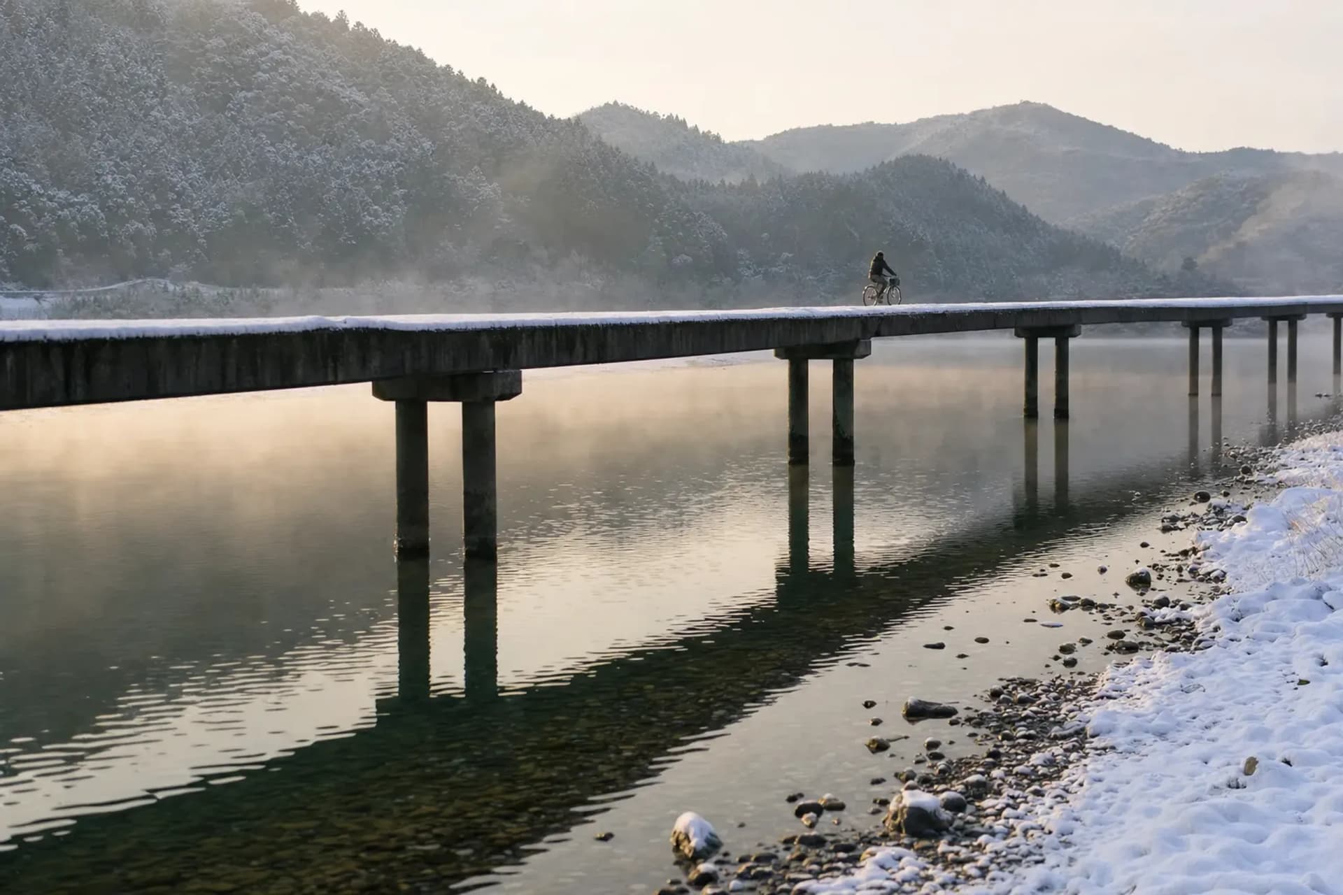
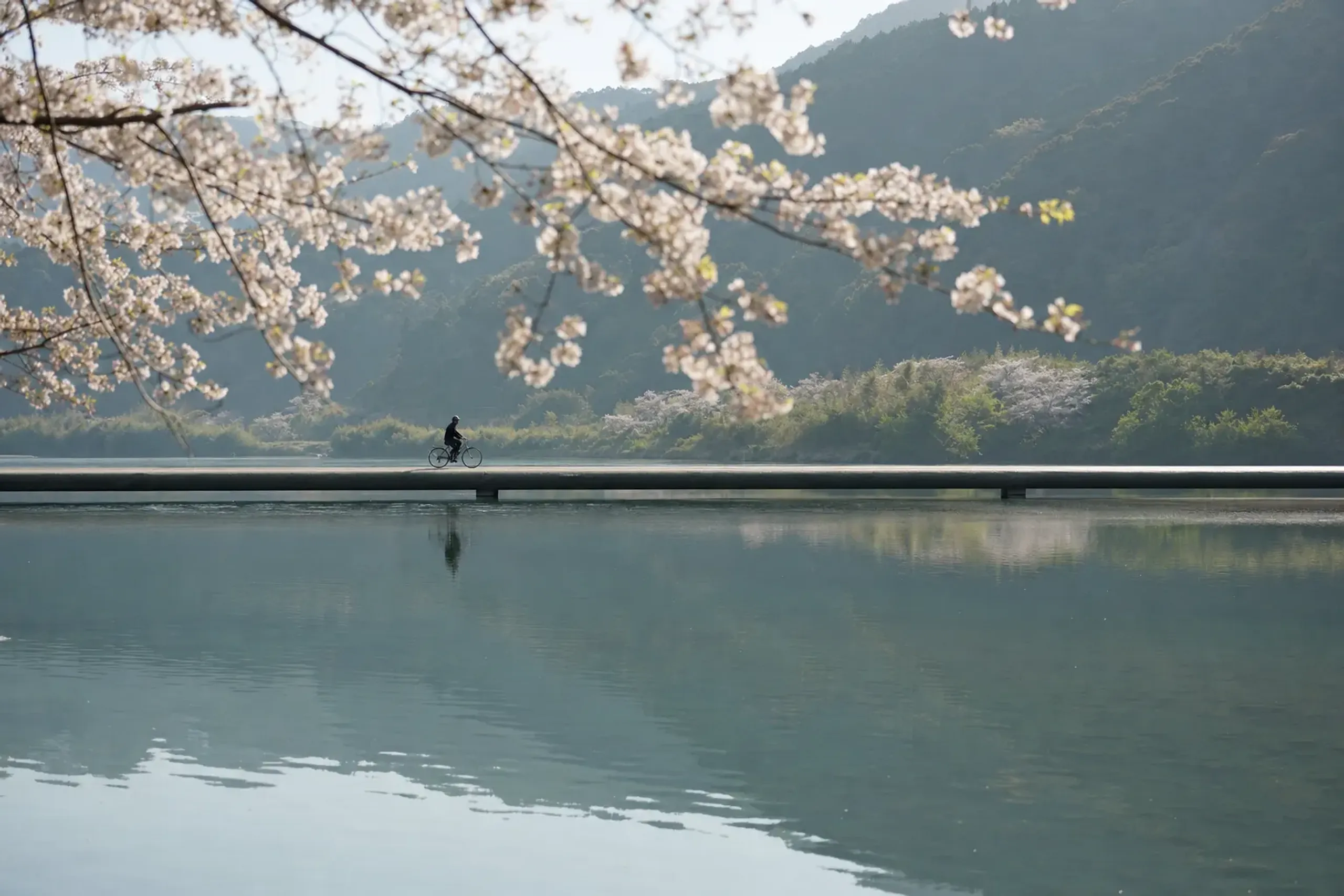
The bridge sits low. Almost apologetically low, a pale concrete ribbon laid just above the surface of the Shimanto River in western Kōchi. There is no railing. Nothing to hold, nothing to lean on, nothing between your feet and the water sliding beneath. In late summer, after the rains, the river swells brown and fast, and the span you crossed yesterday is gone — not broken, not swept away, just underwater, waiting.
This is a chinkabashi. A sinking bridge. And it explains the Shimanto better than any nickname ever could.
A Label That Is True Only By Definition
People call the Shimanto "Japan's last clear stream." It is a lovely phrase, repeated on tourism pages and travel features, and it carries a certain romance. But it is worth being precise about what it means — because the precision is where the real story lives.
The claim rests on one fact: no large dam has been built on the river's main stream. Under Japanese law, a dam is a barrier of 15 metres or higher. Anything lower is classed as a weir. And there is a weir. Built at Saga in 1937, during the wartime rush for electricity, it is reported to divert part of the river's water to a hydroelectric plant and release it into a neighbouring river system — an unusual arrangement the terrain happened to allow. The tributaries, meanwhile, do carry hydroelectric dams.
So the label holds. But only by the letter of a definition.
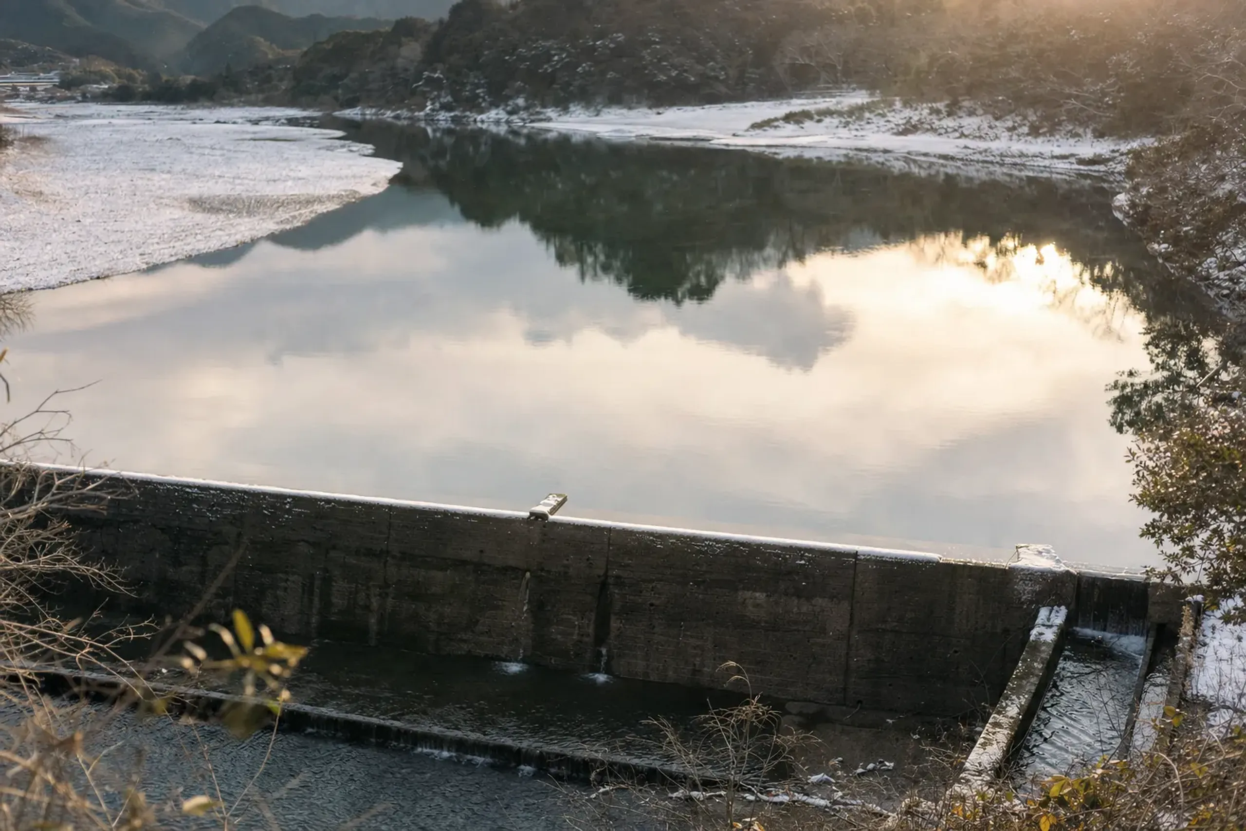
Key fact: "No dams" is accurate only under Japanese law, which counts a dam at 15 metres or higher. A 1937 weir at Saga still diverts part of the flow, and the tributaries carry hydroelectric dams.
What the river genuinely offers is something the nickname gestures at but never quite names. Not perfect water. A river left, on its main stream, largely free to flood — and a landscape built to yield to it rather than fight it. The sinking bridges are the honest proof.
What "No Dams" Actually Means
We think it matters to hand our guests the whole picture, not the postcard.
The Saga weir story rests on a single detailed source, so we describe its effects modestly. It exists. It diverts water. Beyond that, we don't overstate. In the late 1980s, residents alleged that dams were causing sludge to build up and were blocking fish ladders; a removal movement followed. The cause of the river's troubles has never been cleanly settled, and honest people still disagree.
More recently, a February 2026 news analysis reported survey findings of pollution across a wide area of the river, along with restoration efforts that have begun. We pass that along neutrally — attributed to that analysis, neither dramatised nor waved away. A river this celebrated attracts scrutiny, and scrutiny is not the same as ruin.
None of this makes the Shimanto less worth seeing. It makes it more interesting.
This is a working river that people chose to build around rather than against, and that decision is written into the bridges.
The River Itself
At 196 kilometres, the Shimanto is the longest river in Shikoku. It rises on Mount Irazu, 1,336 metres, in the town of Tsuno, then traces a long inverted-S — through Yusuhara, Nakatosa, Shimanto town, and Shimanto city — before reaching the Pacific. Near its mouth the river takes the name Watarigawa, which is why its water system is officially the Watarigawa system.
It stands among Japan's three great clear streams, alongside the Nagara and the Kakita. If you want to understand what that fellowship means in practice, the Nagara has its own theatre: the cormorant fishing tradition that still draws crowds on summer nights. Two rivers, two temperaments, one rare distinction.
The name "Shimanto" itself is unsettled. One account reads it as "a large, beautiful river." We offer that as a story, not a fact — the etymology has never been pinned down, and we prefer not to pretend otherwise.
Why The Shimanto's Bridges Have No Railings
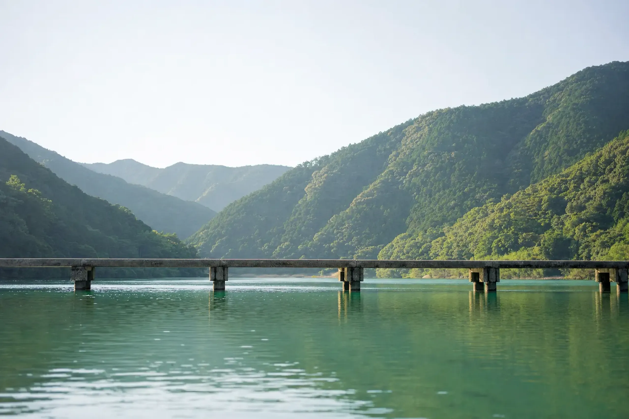
The Shimanto and its tributaries carry 47 chinkabashi — low bridges built deliberately without parapets, so that floodwater passes over them rather than piling against them and tearing them from their footings.
That is the whole logic. A railed bridge catches debris in a flood. Logs, branches, whole trees jam against the barrier, the water backs up, the pressure builds, and eventually the structure fails.
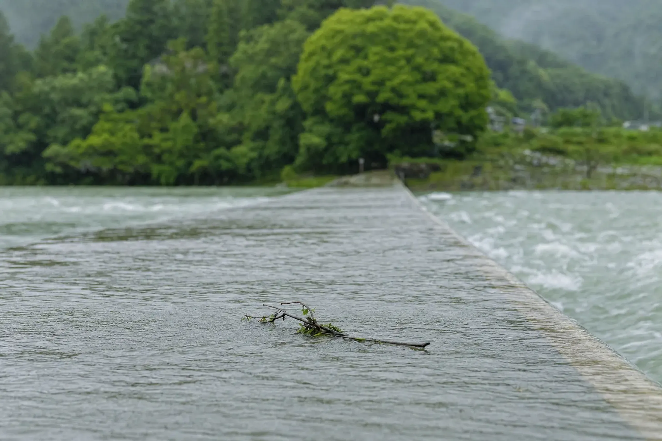
Strip away the railing, sit the deck low, and the river simply flows over the top. The bridge disappears for a day or two, then re-emerges, intact, as the water drops. It is engineering as humility.
In 1993, Kōchi Prefecture decided to preserve them as living-culture heritage — a specific, checkable act of recognition. These are not quaint relics. They are still in use, still crossed by farmers and schoolchildren and the occasional startled visitor.
Two are best known. Sada Chinkabashi, on the lower river, is the longest bridge on the popular cycling stretch and the one most photographed — a pale line running clean across the width of the water. The Iwama bridge in Shimanto city is the other name people mention first. Standing on either, with no rail and the river moving below, you feel the design in your knees before you understand it in your head.
The Kōchi tourism board, quite sensibly, recommends dismounting and walking across the narrower crossings. On foot, the point of a chinkabashi lands harder. There is nothing to save you. There was never meant to be. The bridge was built to lose its argument with the river, gracefully, again and again.
What Is Summer On The Shimanto River Really Like?
Summer is peak river season on the Shimanto — and also peak flood season. It is hot, humid, green, and beautiful, and levels can rise fast with rain or a passing typhoon, which sometimes closes the sinking-bridge crossings entirely.
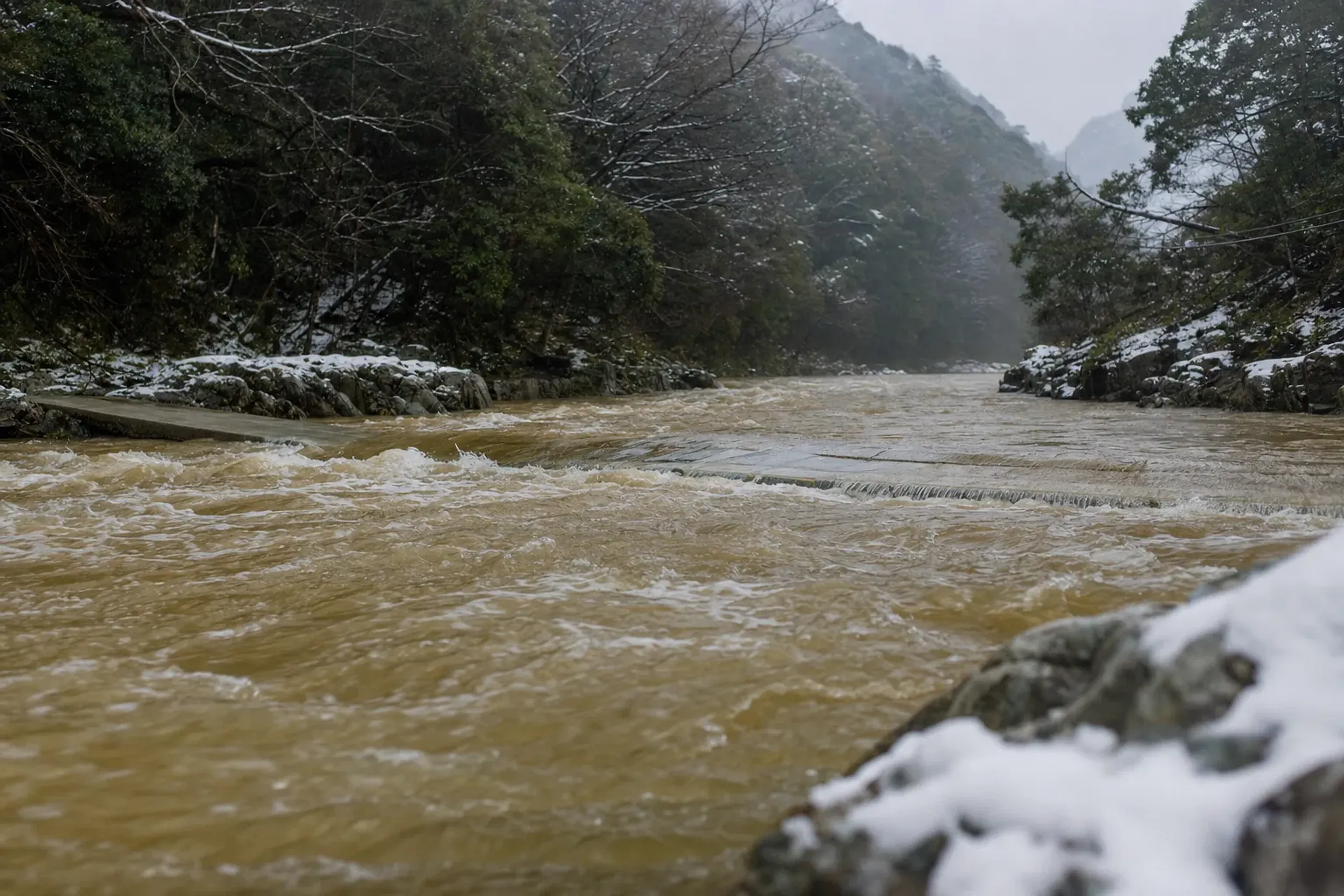
That contradiction is the honest heart of a summer visit. The bridges are at their most eloquent exactly when the weather makes them hardest to reach. We would rather tell you that plainly than sell you a risk-free postcard.
On The Water
Guided canoe and kayak tours run through the warm months, including beginner courses, in half-day and full-day formats. These are public offerings, open to anyone; there is no private stretch of river and no secret route, and we would never pretend otherwise. What our team adds is the arranging — matching you to a reputable local operator, timing the outing to conditions, and getting you there and back in comfort.
Slower still is the yakatabune, the traditional roofed pleasure boat that drifts a calm section of the river while you sit low to the water. For guests who want the river without the paddling, it is the gentler introduction.
On Two Wheels
The river corridor is made for unhurried cycling. Shimanto Rin-Rin Cycle rents bicycles across nine terminals along roughly 40 kilometres between the area near Nakamura Station and Ekawasaki Station, which means you can ride one way and return the bicycle at the far end. The Kōchi tourism board describes the Nakamura Station to Camp Village Kawarakko section as having few hills — a genuinely easy day, with chinkabashi to walk across along the route.
On The Trail
Guided treks reach the river's source on Mount Irazu, and are described as suitable for beginners.
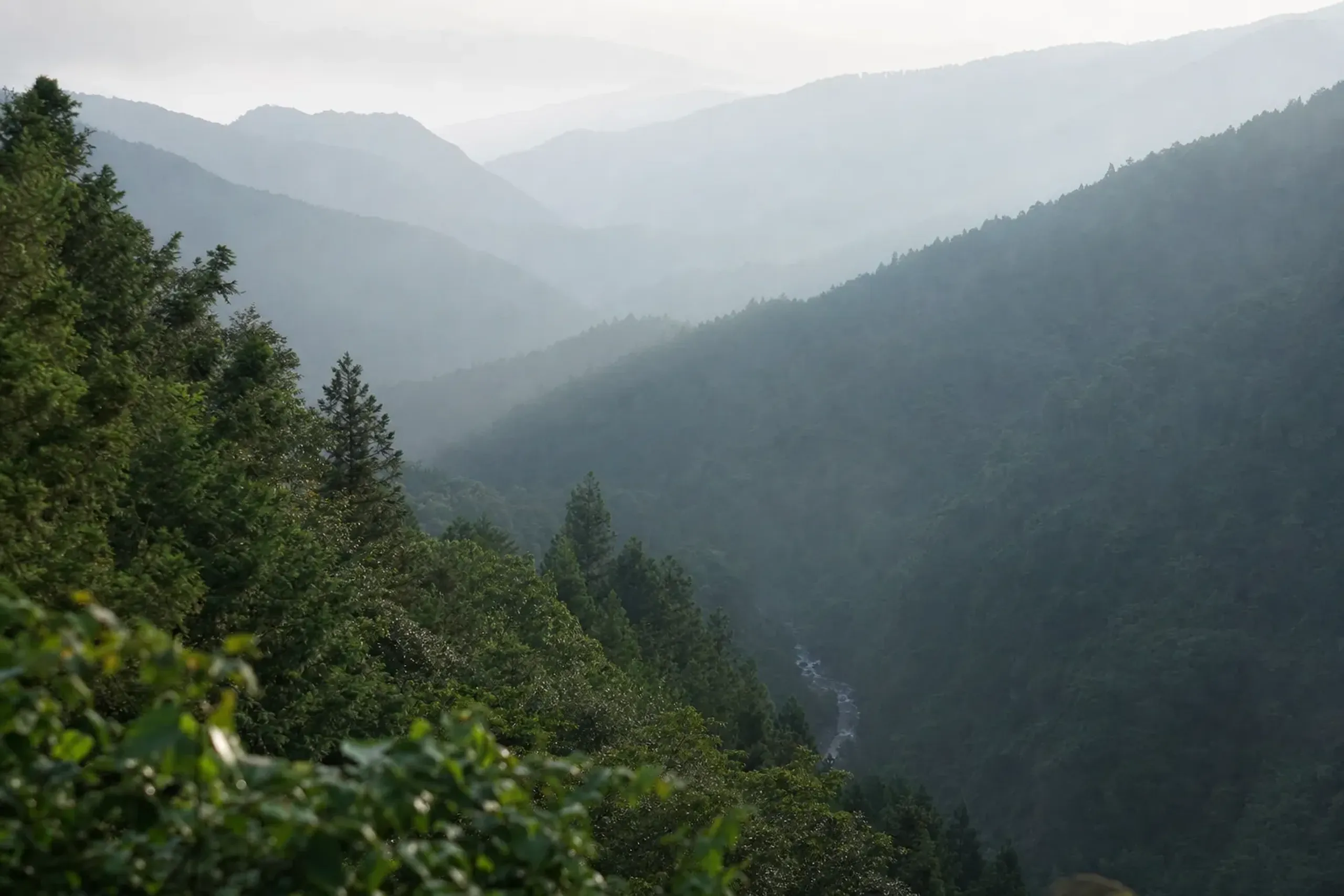
To stand at the spring where a 196-kilometre river begins as a trickle is a quiet, disproportionate pleasure.
On The Table
Traditional river fishing survives here. Fishers still take natural eel, ayu sweetfish, and river shrimp — and ayu is the official fish of Shimanto city. Seasons and rules shift year to year, so our concierge team verifies fishing seasons, current river conditions, and activity availability on your behalf before you arrive. It is the least interesting part of the trip and the part most likely to save your day.
How To Reach The Shimanto And How Long To Stay
The Shimanto sits in the far west of Kōchi Prefecture, and reaching it from Kōchi city is a real journey, not a hop — check current rail and road schedules, because they change. This is emphatically not a day trip.
A 2026 Kōchi travel guide is candid on this point: the area is far-western and takes substantial travel time to reach, and it rewards a stay rather than a stop. We agree. Give it two or three nights. Ride one day, drift another, walk to the source on a third, and let the river set the pace.
Nakamura Station is the practical gateway, with onward transport fanning out from there. Our private chauffeured transport smooths the long connections and the awkward gaps between rail and riverbank, so the distance stops being a chore.
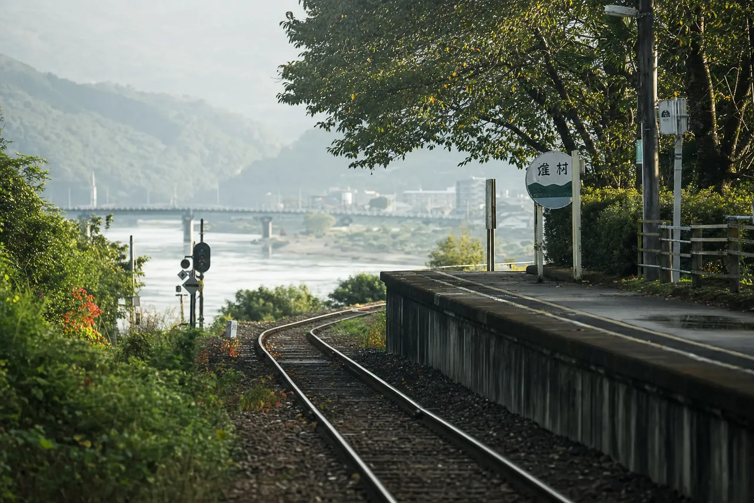
For where to rest between outings, our team advises on accommodation suited to a slower western-Shikoku itinerary.
If you are already weighing a Kōchi trip, the prefecture has more than one kind of summer. Its riotous festival culture across Shikoku sits at the opposite temperament to the Shimanto's stillness — the river is where you go to breathe out.
What Japan Royal Service Arranges Here
Plainly, and once: our team arranges guiding, private transfers, and coordination of guided river activities through local operators. The canoe and trek tours themselves are public offerings; we do not claim private river access or exclusive routes, because none exist. What we hold is the logistics, the timing, and the watchful care around a river that changes its mood with the weather.
A tailor-made western-Kōchi journey can be shaped entirely to your pace. Our team builds each bespoke itinerary around real conditions rather than a fixed brochure, which on a flood-prone river is not a luxury but a necessity.
Frequently Asked Questions
Is The Shimanto River Really Japan's Last Clear Stream With No Dams?
No large dam sits on the main stream, which is the basis for the nickname — but Japanese law counts a dam only at 15 metres or higher. A 1937 weir at Saga still diverts water, and the tributaries carry hydroelectric dams.
What Are The Chinkabashi Sinking Bridges On The Shimanto?
They are 47 low bridges built without railings so floodwater flows over them instead of destroying them.
Kōchi Prefecture decided to preserve them as living-culture heritage in 1993. Sada Chinkabashi and the Iwama bridge are the best known.
Can You Canoe Or Cycle On The Shimanto River In Summer?
Yes. Guided canoe and kayak tours, including beginner courses, run in half-day and full-day formats, and Shimanto Rin-Rin Cycle rents bicycles across a roughly 40-kilometre corridor. Summer river levels can rise quickly and close crossings, so conditions should be checked first.
How Long Should I Stay At The Shimanto River?
Plan two to three nights. The river sits in far-western Kōchi and takes substantial travel time to reach, so a multi-night stay lets you cycle, drift by yakatabune, and trek to the source without rushing the long connections.
Why Choose Japan Royal Service
A river built to flood asks for a planner who respects conditions over itineraries. That is where our team earns its keep. We verify what changes — river levels, activity availability, fishing seasons — and we handle the long western-Shikoku transfers that turn a hard-to-reach place into an easy one, all with the discretion our guests expect and the honesty this particular river deserves. We will not sell you clear water we cannot promise. We will show you a free-flowing river and the bridges built to bow to it.
To shape a private Shimanto journey around real conditions, reach our team privately via WhatsApp or LINE, or contact us here.